 |
Glacier-Bay
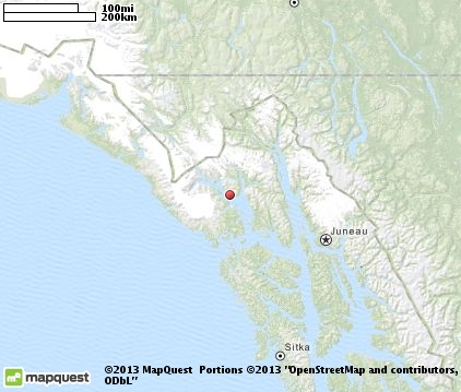
is located in southeastern Alaska. The area, which encompasses the bay and surrounding mountains and glaciers, was first proclaimed a U.S. National Monument on February 25, 1925. Later, on December 2, 1980, the area was enlarged and designated a National Park and Preserve under the Alaska National Interest Lands Conservation Act. Glacier Bay National Park and Preserve consists of 3,283,000 acres and in 1986, UNESCO declared an area of 57,000 acres within it as a World Biosphere Reserve. This is the largest UNESCO protected biosphere in the world. In 1992, UNESCO included this area as a part of a World Heritage site, extending over an area of 24,300,000-acres, which also included the Wrangell-St. Elias National Park, Kluane National Park (Canada) and Tatshenshini-Alsek Park (Canada). Part of the Glacier Bay National Park is also a designated wilderness area covering 2,658,000 acres. Glacier Bay, the actual body of water, covers 1,275 square miles of glaciers and accounts for 27 percent of the park. It was a large single glacier of solid ice until the early 18th century, when it started retreating. Glacier Bay is a popular cruise ship destination. Rugged mountains, glaciers, rainforest, wild and wonderful coastlines, deep fjords, and spectacular wildlife are all a part of this nearly 25-million acre World Heritage Site. Things to do include hiking, kayaking, camping, backpacking, rafting, cruising, charter a boat, or bring your own for the tour of a lifetime.

|
Glacier Bay Vacation Rentals
|

|
|
|

|
Glacier Bay Hotels and Resorts
|

|
|

|
Glacier Bay Weather & Climate
|

|
|
|
Southeastern Alaska, in the Glacier Bay Basin region, has three different climatic zones. Overall, the region has a cool, wet, coastal rainforest climate. The outer coast area along the Gulf of Alaska has milder temperatures and higher rainfall, but less snowfall. The Upper Glacier Bay is much colder with heavy snowfall. The Lower Glacier Bay experiences heavy rainfall throughout the year. On average, there are 228 days of precipitation each year. Summer temperatures are cool, usually between 50 and 60 degrees F. Winter temperatures generally range between 20 - 30 degrees F., but can drop as low as minus 10 F.
|
| Month |
High Temp |
Low Temp |
Rainfall |
Ocean Temp |
| January |
32°F |
23°F |
6.52 in. |
- |
| February |
35°F |
25°F |
4.81 in. |
- |
| March |
39°F |
28°F |
3.60 in. |
- |
| April |
48°F |
32°F |
2.80 in. |
- |
| May |
55°F |
38°F |
3.69 in. |
- |
| June |
61°F |
43°F |
3.02 in. |
- |
| July |
64°F |
46°F |
3.61 in. |
- |
| August |
62°F |
46°F |
5.56 in. |
- |
| September |
56°F |
42°F |
9.47 in. |
- |
| October |
47°F |
36°F |
11.83 in. |
- |
| November |
38°F |
29°F |
7.46 in. |
- |
| December |
34°F |
25°F |
7.31 in. |
- |

|
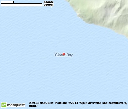
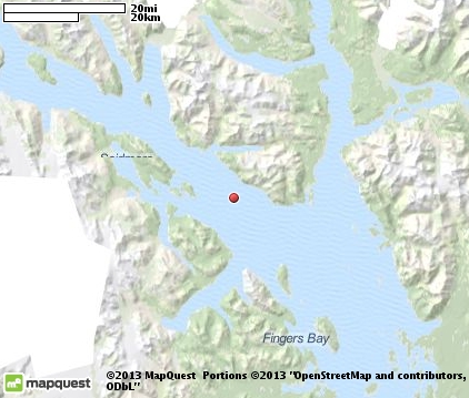
Glacier Bay Map & Transportation
|

|
|
 |
|
|
| Click each thumbnail image to enlarge. |
 |
 |
 |
 |
The closest airports in the area are the Gustavus airport (GST) located about 32 miles southeast of Glacier Bay in Gustavus, Alaska and the Juneau International airport (JNU) located approximately 69 miles southeast of Glacier Bay in Juneau, Alaska.
|

|
Glacier Bay Attractions
|

|
|
| | | Ski Areas |
| Eaglecrest | Juneau | AK | 76.5 mi. | |
Notice a problem with the information on this page? Please notify us.
|
Disclaimer: We recommend you conduct your own research regarding all accomodations and attractions found on this website. The distances shown on this website are straight-line distances as the crow flies. The road distance may be considerably longer. You assume all liability for use of any information found on this website. No information is confirmed or warranted in any way. By using our services you agree to the terms and conditions of this disclaimer.
|
| We are the #1 site for your Alaska Vacation presenting Alaska vacation rentals, hotels, weather and map for each city. |
Alaska Vacation .com
©1997-2025 All Rights Reserved.
|
|